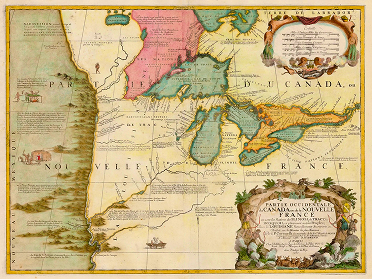
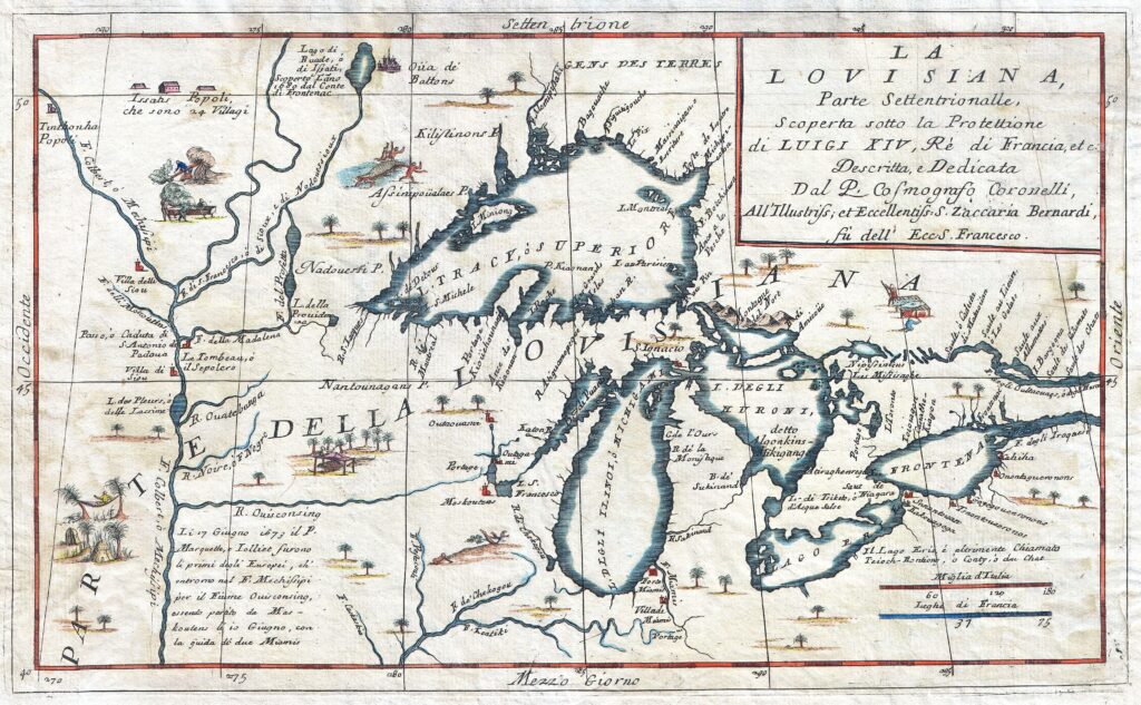
While the state of Illinois was not one of the original Thirteen Colonies of British North America, our state also has a colonial past and a handful of colonial-era sites. Illinois and the entire Mississippi watershed was fist colonized by the French and remained under French control until the conclusion of the French and Indian War in 1763. Unlike the dense settlements of the British colonies along the Atlantic coast, the French colonial presence was very limited and largely focused on trade. Within Illinois, the French establish a patchwork of thinly populated settlements to facilitate trade, serve as bases for further exploration, and maintain a minimal level of administrative control over a vast geographic territory.
Below you will find descriptions of some of the colonial era sites in Illinois which may be visited by the public. For further information on the colonial history of Illinois from a French perspective, please explore the work of the following organizations:
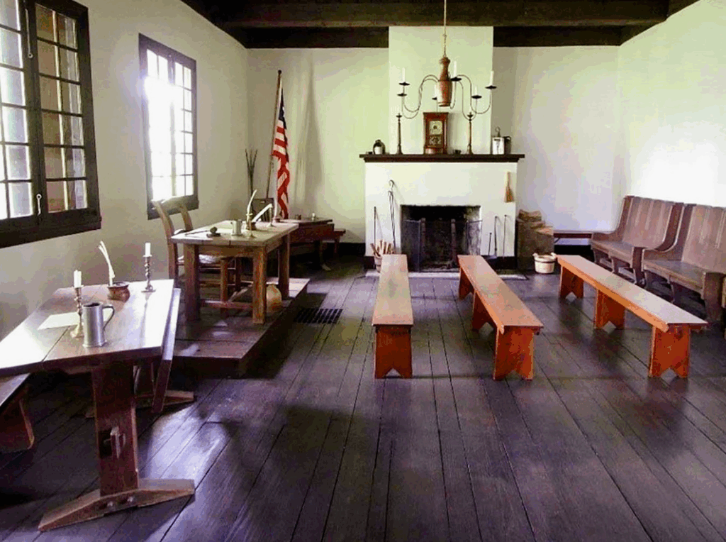
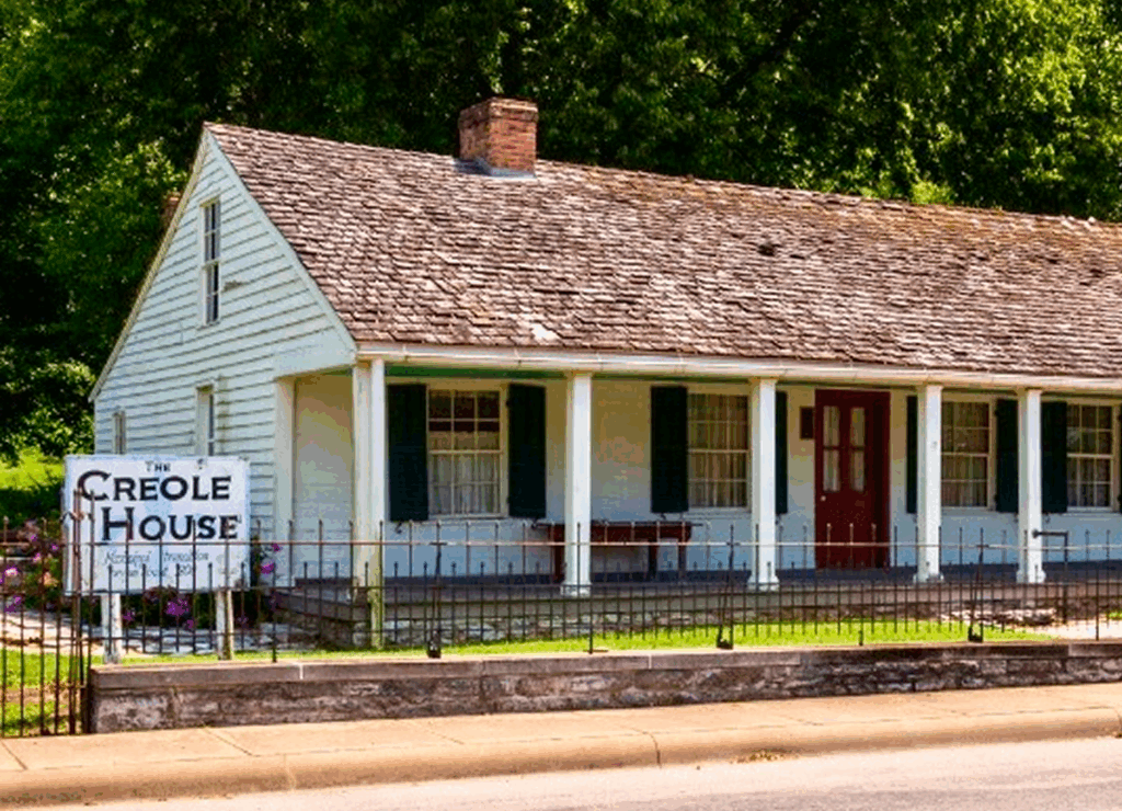
The Cahokia Courthouse, located in present-day Illinois, stands as a rare architectural survivor from the period of French colonial settlement in the Mississippi Valley and later served as a significant seat of American territorial administration. Originally constructed circa 1740 as a French poteaux-sur-sol dwelling—a timber-frame structure resting on a horizontal sill—it exemplified the vernacular architecture employed by settlers of the Illinois Country. Though modest in scale, the building occupied a central position in the village of Cahokia, one of the principal French settlements east of the Mississippi and a hub of ecclesiastical, mercantile, and administrative activity. Its adaptation to governmental use following the American acquisition of the territory after the Revolutionary War reflects the transitional nature of the region, where Anglo-American legal practices were gradually superimposed on long-standing French civil traditions.
Following the establishment of the Northwest Territory, the building was repurposed in 1790 as the courthouse for St. Clair County—then encompassing a vast portion of the Illinois Country. In this role, the structure served as the administrative center of American authority in a frontier region still culturally and demographically French. Proceedings held there included probate, land disputes, and other civil matters that highlight the legal hybridization of the region during the early republic. The courthouse’s continued use until the early 19th century marks its importance in consolidating federal control over a strategically vital corridor along the Mississippi River.
Fort Kaskaskia
Fort Kaskaskia, situated on an eastern bluff overlooking the Mississippi River near present-day Chester, Illinois, occupied a pivotal position in the colonial history of the interior Mississippi Valley. Though the fort that bears its name today is a 19th-century earthen reconstruction, the original colonial site was integral to the French imperial system in the Illinois Country (Pays des Illinois). Emerging in the early 18th century within proximity to the French mission and village of Kaskaskia—then among the most significant settlements in Upper Louisiana—the fortification functioned as a local center for defense, trade regulation, and imperial surveillance. It exemplified France’s reliance on a network of strategic outposts and alliances with indigenous peoples, particularly the Illinois Confederation, to maintain influence in a vast, underpopulated frontier.
The strategic significance of Fort Kaskaskia became more pronounced during the imperial transitions of the mid-18th century. Following the French defeat in the Seven Years’ War, the region east of the Mississippi was ceded to Great Britain in 1763, although effective British occupation of the Illinois Country was slow and limited. In 1778, during the American Revolutionary War, George Rogers Clark’s Virginia militia captured Kaskaskia, marking a critical episode in the western campaign to assert American control over the trans-Appalachian frontier. This maneuver contributed to the later legal claims for American possession of the Old Northwest. Fort Kaskaskia and its adjacent village thus not only reflect the entangled sovereignties of French, British, and American colonial powers but also illuminate the deeper contestations over territory, trade, and diplomacy in the heartland of North America.
Fort de Chartres
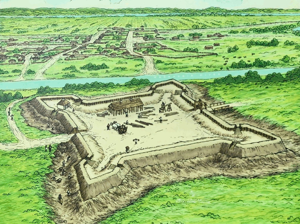
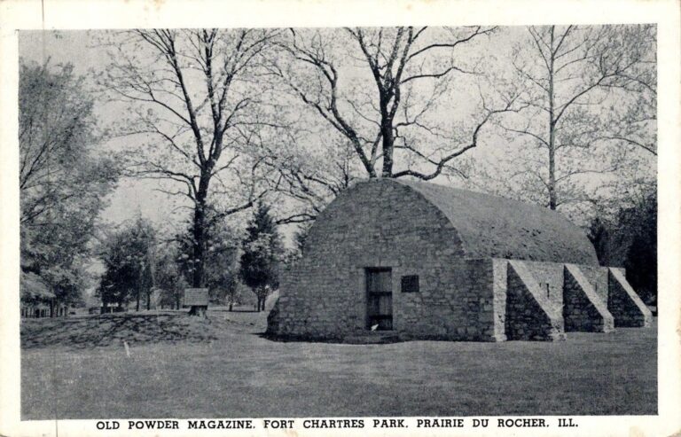
Fort de Chartres, constructed by the French beginning in 1720 on the east bank of the Mississippi River in the Illinois Country, served as the administrative and military seat of French authority in Upper Louisiana. Its establishment was driven both by geopolitical calculations, especially the need to assert control over the interior amid British and Spanish competition, and by the economic interests of the Company of the Indies, which hoped to exploit regional mineral resources. The original wooden fortification, subject to frequent flooding, was gradually replaced by a more durable limestone structure completed in 1753. The fort became a physical manifestation of French imperial presence in the Mississippi Valley, housing a garrison, a commandant’s residence, and judicial and financial offices. Its location allowed for the surveillance of trade routes, oversight of native diplomacy, and coordination with ecclesiastical and civilian authorities in nearby villages such as Prairie du Rocher and Kaskaskia.
The significance of Fort de Chartres extended well beyond its architectural footprint. It functioned as the nerve center of French colonial administration in the interior, where imperial sovereignty had to be negotiated through flexible relationships with native polities, including the Illinois Confederation and others who traversed the region. After the Treaty of Paris in 1763, which ceded French territories east of the Mississippi to Britain, Fort de Chartres briefly became the locus of British power in the Illinois Country. However, British control remained fragile and peripheral, and the fort was ultimately abandoned by 1772 due to environmental degradation and strategic recalibration. In the longue durée of colonial North America, Fort de Chartres epitomized the tensions between European imperial ambition and the diplomatic and logistical realities of the continental interior.
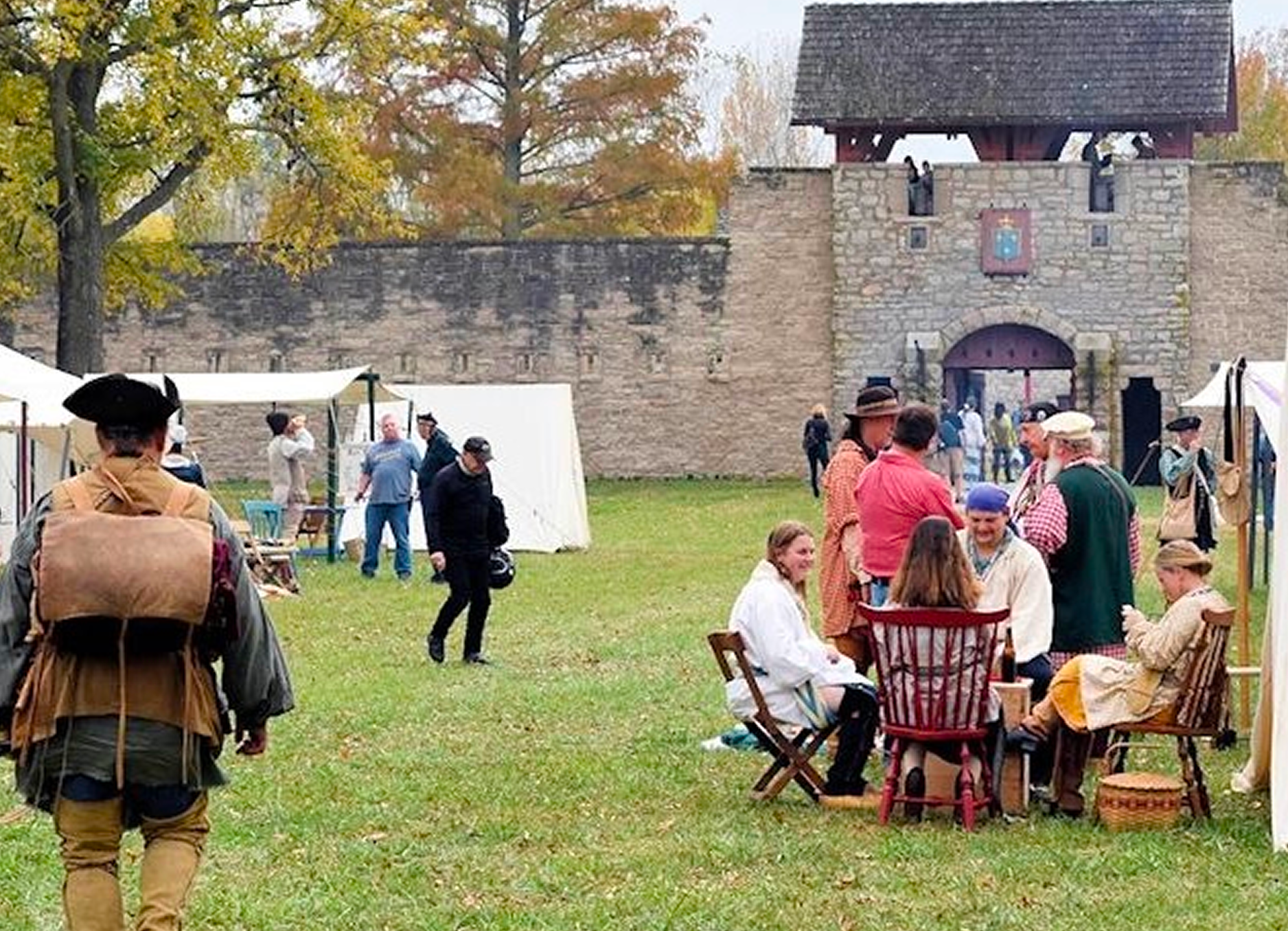
Prairie du Rocher
Established in 1722 by settlers of French origin along the eastern bank of the Mississippi River, Prairie du Rocher quickly developed into one of the principal agricultural villages of the Illinois Country during the French colonial period. Located in proximity to Fort de Chartres, the village served as a civilian counterpart to the military presence in the region. Its land division reflected the traditional French seigneurial system, employing long, narrow plots perpendicular to the river, which allowed for equitable access to water and arable land. Communal fields and shared pastures supported a cooperative agricultural economy oriented toward wheat production and local trade. The population, composed largely of Canadians and their descendants, brought with them established patterns of Catholic worship, civil law, and customary agricultural practices adapted to the Mississippi floodplain.
Prairie du Rocher remained a distinctly French village even after the cession of the territory to Great Britain in 1763, following the Treaty of Paris. The inhabitants, though technically British subjects, maintained their language, religion, and legal traditions with minimal interference. The area preserved a strong sense of local autonomy and continuity well into the early American period. While never a major center of population or commerce, the village held strategic and symbolic importance as a well-ordered example of French colonial rural life in the interior. Its survival through multiple changes of sovereignty stands as a testament to the stability and tenacity of traditional colonial institutions in the Mississippi Valley.
Colonial Illinois Timeline
1673
French explorers Jacques Marquette and Louis Jolliet become the first Europeans to explore the Illinois River valley.
1675
Father Marquette establishes a mission at Kaskaskia to convert the local Native American tribes.
1680
René-Robert Cavelier, Sieur de La Salle, builds Fort Crèvecoeur near present-day Peoria.
1682
La Salle claims the Mississippi River basin, including Illinois, for France, naming it “Louisiana.”
1691
Kaskaskia becomes one of the first permanent European settlements in Illinois.
1703
The French establish a settlement at Cahokia, which becomes a major center for trade and missionary work.
1717
Illinois Country is officially organized as part of the French colony of Louisiana.
1720
Fort de Chartres is constructed near the Mississippi River as a key French military and administrative center.
1730
The French and their Native American allies defeat the Fox tribe near present-day Illinois in the Fox Wars.
1752
The population of Illinois Country grows, with French settlers establishing farms along the Mississippi River.
1763
The Treaty of Paris ends the French and Indian War; France cedes Illinois to Britain.
1765
British forces take control of Fort de Chartres, completing the transfer of Illinois to British rule.
1768
The British survey Illinois lands and begin regulating the fur trade with Native Americans.
1772
Fort de Chartres, damaged by flooding, is abandoned by the British; they move to Fort Gage at Kaskaskia.
1778
George Rogers Clark captures Kaskaskia for the Americans during the Revolutionary War, bringing Illinois into the American sphere.
1783
The Treaty of Paris ends the Revolutionary War; Britain cedes the Illinois Country to the United States.
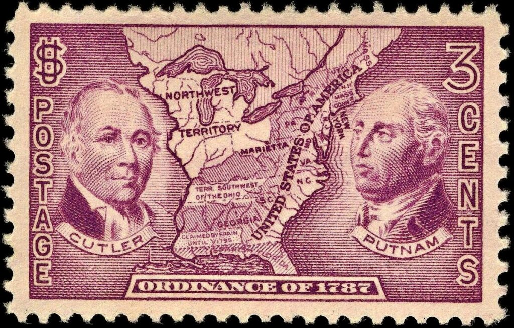
1787
The Northwest Ordinance organizes the Illinois area into the Northwest Territory, opening it for settlement.
1795
The Treaty of Greenville opens much of southern Illinois to American settlers after conflicts with Native tribes.
Colonial Illinois Timeline
1673
French explorers Jacques Marquette and Louis Jolliet become the first Europeans to explore the Illinois River valley.
1675
Father Marquette establishes a mission at Kaskaskia to convert the local Native American tribes.
1680
René-Robert Cavelier, Sieur de La Salle, builds Fort Crèvecoeur near present-day Peoria.
1682
La Salle claims the Mississippi River basin, including Illinois, for France, naming it “Louisiana.”
1691
Kaskaskia becomes one of the first permanent European settlements in Illinois.
1703
The French establish a settlement at Cahokia, which becomes a major center for trade and missionary work.
1717
Illinois Country is officially organized as part of the French colony of Louisiana.
1720
Fort de Chartres is constructed near the Mississippi River as a key French military and administrative center.
1730
The French and their Native American allies defeat the Fox tribe near present-day Illinois in the Fox Wars.
1752
The population of Illinois Country grows, with French settlers establishing farms along the Mississippi River.
1763
The Treaty of Paris ends the French and Indian War; France cedes Illinois to Britain.
1765
British forces take control of Fort de Chartres, completing the transfer of Illinois to British rule.
1768
The British survey Illinois lands and begin regulating the fur trade with Native Americans.
1772
Fort de Chartres, damaged by flooding, is abandoned by the British; they move to Fort Gage at Kaskaskia.
1778
George Rogers Clark captures Kaskaskia for the Americans during the Revolutionary War, bringing Illinois into the American sphere.
1783
The Treaty of Paris ends the Revolutionary War; Britain cedes the Illinois Country to the United States.
1787
The Northwest Ordinance organizes the Illinois area into the Northwest Territory, opening it for settlement.
1795
The Treaty of Greenville opens much of southern Illinois to American settlers after conflicts with Native tribes.